Trail Walking La Chabanne - Balade autour de La Chabanne - Photo

Balade autour de La Chabanne

 tracegps
tracegps

User

© OpenStreetMap contributors
Length
Length
7.1 km
Max alt
Max alt
829 m
Uphill gradient
Uphill gradient
257 m
Km-Effort
Km-Effort  
10.6 km
Min alt
Min alt
607 m
Downhill gradient
Downhill gradient
259 m
Boucle
Boucle
No
Creation date :
2014-12-10 00:00:00.0
Updated on :
2014-12-10 00:00:00.0

(0 Reviews)

Walking
Walking
1h45
Difficulty : Easy

Scan this QR Code to open this trail in the SityTrail application

FREE GPS app for hiking

Logo SityTrail SityTrail

IGN / Geographical institutes

Download SityTrail from the App Store Download SityTrail from Google Play

Logo SityTrail SityTrail World

The world is yours!

Download SityTrail from the App Store Download SityTrail from Google Play Download SityTrail on Huawei AppGallery

About

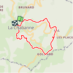
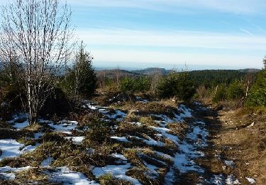
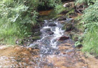
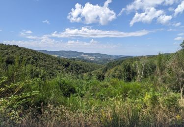
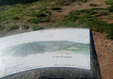
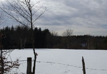
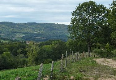
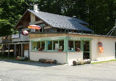
Trail Walking of 7.1 km to be discovered at Auvergne-Rhône-Alpes, Allier, La Chabanne. This trail is proposed by tracegps.

Description

Circuit très facile en sous bois.

Elevation profile

Photos

Positioning

Country:
France
Region :
Auvergne-Rhône-Alpes
Department/Province :
Allier
Municipality :
La Chabanne
Location:
Unknown
Start:(UTM)
558128 ; 5096906 (31T) N.

Trails nearby

Trail Walking Saint-Nicolas-des-Biefs - Ronde boisée des rochers et des ruisseaux - La Verrerie - Photo
Walking
tracegps

Walking

Difficult
(3)
Saint-Nicolas-des-Biefs, Auvergne-Rhône-Alpes, Allier, France
10.3 km | 14.8 km-effort
3h 0min
Yes
Trail Walking Les Noës - Les Grands Joncs - Les Noës - Photo
Walking
tracegps

Walking

Medium
(3)
Les Noës, Auvergne-Rhône-Alpes, Loire, France
12.2 km | 18.2 km-effort
3h 15min
Yes
Trail Walking Les Noës - Nouvelle Piste Forestière entre le Rocher de Rochefort et le Plan du Grand Jonc - Photo
Walking
tracegps

Walking

Medium
(1)
Les Noës, Auvergne-Rhône-Alpes, Loire, France
12.8 km | 17.1 km-effort
3h 0min
Yes
Trail Walking Saint-Nicolas-des-Biefs - St Nicolas- circuit du Barbenan - Photo
Walking
coco03

Walking

Medium
(2)
Saint-Nicolas-des-Biefs, Auvergne-Rhône-Alpes, Allier, France
11.6 km | 16.6 km-effort
3h 38min
Yes
Trail Walking La Chabanne - périasse boucle 7 km - Photo
Walking
famillerudent

Walking

Easy
La Chabanne, Auvergne-Rhône-Alpes, Allier, France
7.3 km | 10.4 km-effort
2h 40min
Yes
Trail Walking Saint-Nicolas-des-Biefs - rando du roc du Vacher à St Nicolas des Biefs - Photo
Walking
mimi69670

Walking

Easy
Saint-Nicolas-des-Biefs, Auvergne-Rhône-Alpes, Allier, France
8.7 km | 11.4 km-effort
2h 49min
Yes
Trail Snowshoes Les Noës - la loge aux gardes - Photo
Snowshoes
jojoh2o

Snowshoes

Easy
Les Noës, Auvergne-Rhône-Alpes, Loire, France
4.3 km | 5.5 km-effort
1h 7min
Yes
Trail Mountain bike Laprugne - Randonnée des Monts de la Madeleine «25 ans» (2013-VTT-36km) - La Loge des Gardes - Photo
Mountain bike
tracegps

Mountain bike

Very difficult
Laprugne, Auvergne-Rhône-Alpes, Allier, France
36 km | 53 km-effort
3h 30min
Yes
Trail Mountain bike Laprugne - Randonnée VTT des Monts de la Madeleine (Grand circuit 2012) - Photo
Mountain bike
tracegps

Mountain bike

Very difficult
Laprugne, Auvergne-Rhône-Alpes, Allier, France
43 km | 63 km-effort
4h 15min
Yes


Close
My subscriptions